World Fact Book
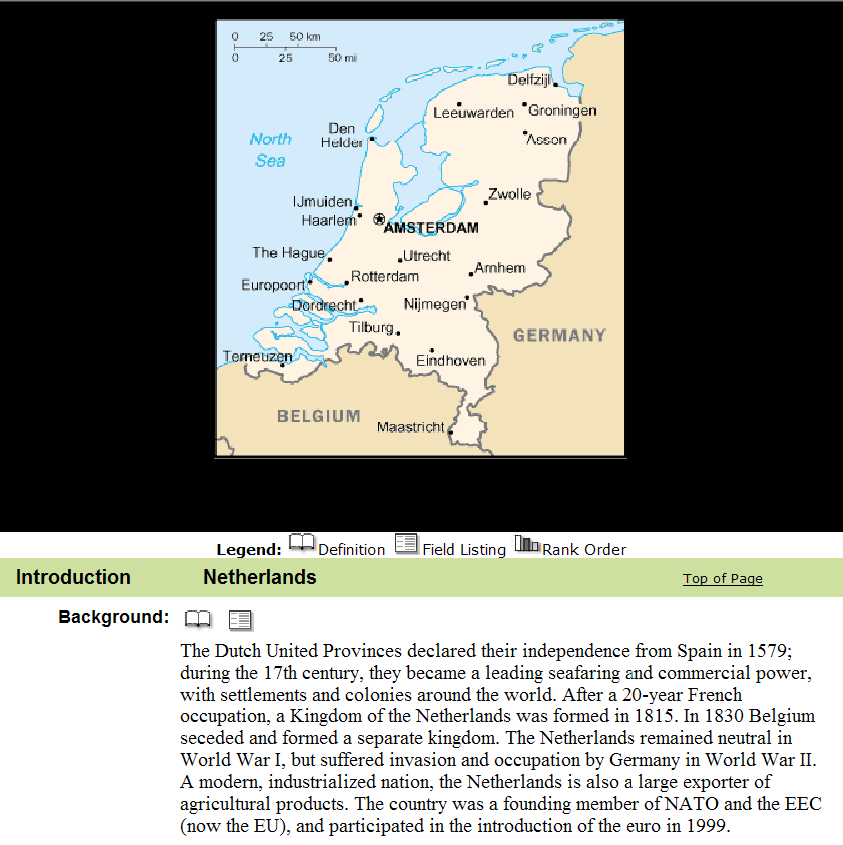 Today there is a lot of information available on the Web that is available for human consumption. CIA World Fact Book is a website that provides a lot of data about countries like their neighbours, export figures, natural resources, gross domestic product (GDP), etc. In this figure one can see an excerpt of the information available for the Netherlands from the CIA World Fact Book website.
The Semantic Web promises to make this information machine-understandable in order to foster Web application interoperability. Given the data represented in the CIA World Fact Book one can build wrappers that will extract the website information and express it in a format that captures besides the data also the meaning of the data.
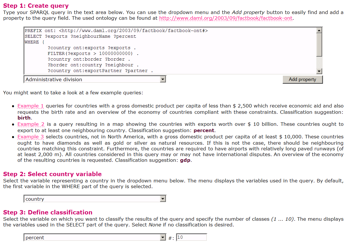 Having the meaning of data defined, i.e., the so-called data semantics, one can envisage many Web applications that can use it. One such application is the customized thematic map that allows querying and visualizing the CIA World Fact Book website based on specific user needs. In this figure one example query is given that retrieves countries that have a GDP greater than 10,000,000,000 US dollars and export to at least one neighbour country.
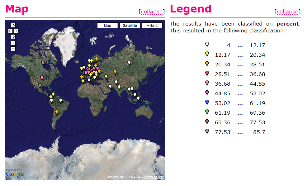 The query results can be presented in a user-friendly way by exploiting visualization techniques specific to the data at hand. The figure to the right shows the results of the above query using Google Maps that were integrated with our application. The results are sorted based on the percentage of export to their neighbours (from the total exports).
One interesting observation that can be concluded from this figure is that there is a correlation between the percentage of export to neighbors and the location of a country. For example the percentage of exports to neighboring countries is very high in Europe. This indicates probably the presence of favorable trade agreements in Europe, information that is not explicitly mentioned in the original website.
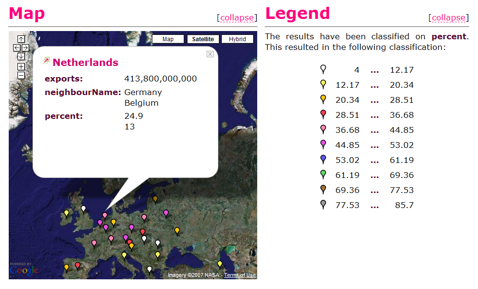 Next to the Semantic Web initiative, Web 2.0 aims at making the Web a true application platform. In order to support such a claim one needs to provide a rich user experience, Web 2.0 application Google Maps being a representative example in this sense. In our application the user can select a certain country and view the query results for the desired country. In this figure one can view the results of the query for the Netherlands.